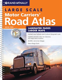
Rand McNally's large scale motor carriers' road atlas 2013 edition, features tear-and water-resistant pages, a spiral binding for stay-flat pages, and maps that are larger with bigger type than those in the regular book. Includes completely revised state and province maps with better urban area representations than in the past, more spatially accurate road network, recalculated mileage representations, larger map scale (and larger type font on the maps) with anti-glare pages, more city maps, easier-to-read map coloring of state-designated truck routes, and direct links to industry information and construction projects to help in planning or while en route.
Latest in Training Products and Tools
Latest in Training Products and Tools


